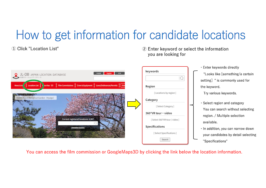
Location List
5,240 potential locations in newly-arrived order.
-
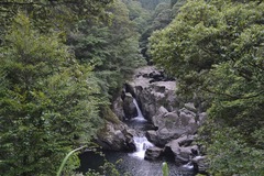
Shitoki DamIwaki City, Fukushima Prefecture
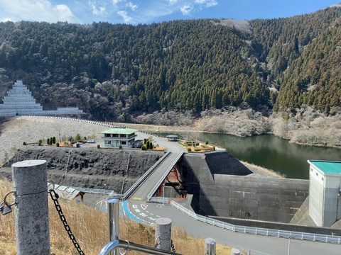
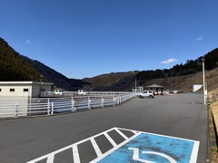
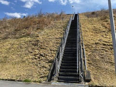
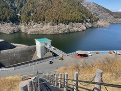
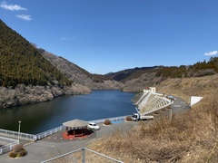
This is a multipurpose dam built on the Shiokigawa River system, a tributary of the Samegawa River in Fukushima Prefecture. It is a large rock-fill dam, standing 83.5 meters tall with a crest lengt...
Category
government & public facilities parksSpecifications
Parking Available Restrooms AvailableFavorites -
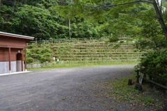
Hokkaido Greenland White ParkIwamizawa City, Hokkaido
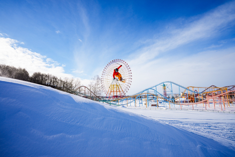
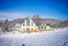
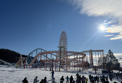
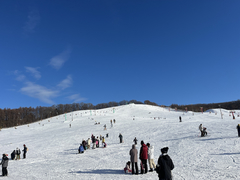
The ski resort is easily accessible, about a one-hour drive from New Chitose Airport and approximately 30 minutes via the highway from Sapporo city. It is adjacent to an amusement park, so a large ...
Category
Nature ski slopes/golf coursesSpecifications
Parking Available Rest Area (rest station) Available Restrooms Available Shooting Time Available Reservations AvailableFavorites -
Tsu City areaTsu City, Mie Prefecture


Tsu City stretches from the port town facing Ise Bay in the east to the deep mountains bordering Nara Prefecture in the west. The urban area features office districts, shopping streets, national an...
Category
offices/commercial buildings (exterior) City Landscapes train stations/station surroundings wide streets with more than 3 lanesSpecifications
360°VR tourFavorites -
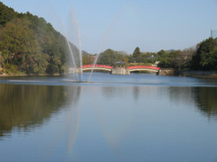
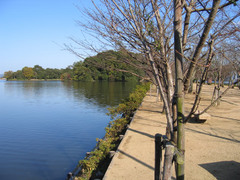
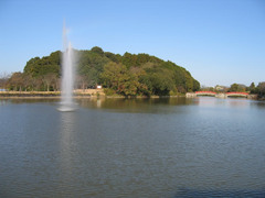
Kimigano DamTsu City, Mie Prefecture


Each season offers a distinct landscape, from cherry blossoms in spring and lush greenery in summer to vibrant autumn foliage and serene snow-covered scenery in winter. The sight of 1,500 cherry tr...
Category
government & public facilities mountain villages lakes/swamps/reservoirs camping grounds/cottagesSpecifications
360°VR tourFavorites -
Kikaku ParkSanuki City, Kagawa Prefecture
Miyai Pond is a vast azure-colored body of water with a turtle-shaped island floating in the center. A 20-meter-wide, 300-meter-long causeway connects the island to the shrine, flanked by large che...
Category
shrines/temples lakes/swamps/reservoirs parksFavorites -
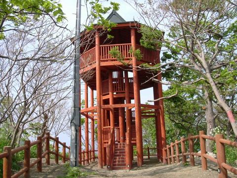
Fujinoki ObservatoryImabari City, Ehime Prefecture
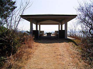
On the way up the mountain along Prefectural Road 51 (Omishima Circular Route), a path through the vacant land on the south side leads to an observation platform with a concrete rest area at the ba...
Category
other facilities views from mountain tops & observatoriesFavorites -
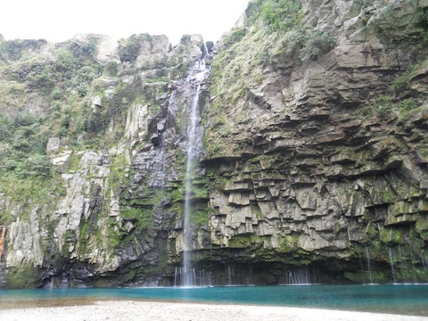
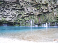
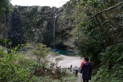
Utsue Shijyuhattaki WaterfallTakayama City, Gifu Prefecture
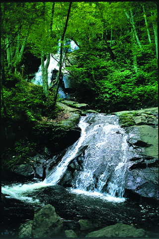
At an elevation of 1,200 meters, surrounded by abundant nature, visitors can discover dozens of waterfalls while taking in the sweeping panorama of the Northern Alps. Spring brings fresh greenery, ...
Category
natural reserves/sanctuaries/scenic spots waterfalls/rivers/streams/canyonsFavorites -
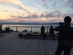
Yuyamawan OnsenNagato City, Yamaguchi Prefecture
This hot spring is situated on a hill within the Kita-Nagato Kaigan Quasi-National Park, overlooking the beautiful Yuyawan Bay. Guests can enjoy breathtaking sunset views from the observation bath,...
Category
hotels/innsFavorites -
Niigata City Honcho MarketNiigata City, Niigata Prefecture
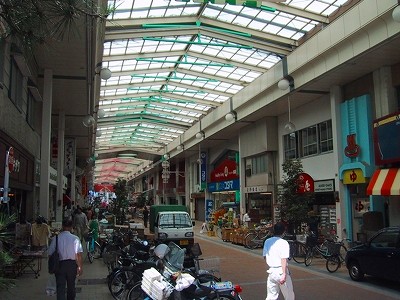
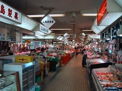
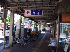
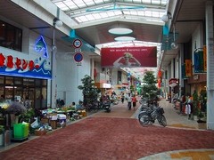
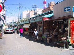
Known as the kitchen of Niigata City, Honcho Market offers a wide selection of fresh seafood delivered directly from the port, locally harvested agricultural products, and everyday necessities. Man...
Category
markets/wholesale marketsSpecifications
Parking AvailableFavorites -
Harunako Auto Camp GroundTakasaki City, Gunma Prefecture


This auto campsite is located about 2 kilometers from Lake Haruna, nestled in a beech forest at the summit of Mount Haruna. At an elevation of 1,140 meters, the temperature is approximately 10°C lo...
Category
Nature camping grounds/cottagesSpecifications
Parking Available Shooting Time Available Requirements for ShootingsFavorites -
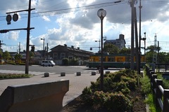
Echizen RailwaySakai City, Fukui City, Katsuyama City, Fukui Prefecture
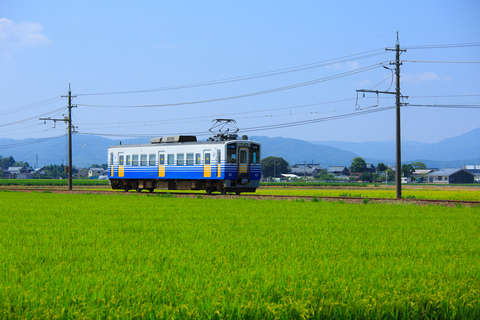
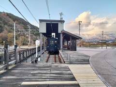
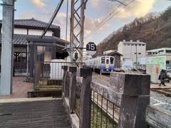
Echizen Railway is a local railway operating in Fukui Prefecture, consisting of two lines: the Katsuyama Eiheiji Line and the Mikuni Awara Line. Established in 2003, it took over the former lines o...
Category
trains/streetcars/monorailsSpecifications
Parking Available Restrooms AvailableFavorites -
Ogawanotaki WaterfallMinamiosumicho, Kagoshima Prefecture
This waterfall is located upstream of the Ogawa River in the Nejime area of Minami Osumi Town, standing 46 meters high and 60 meters wide. A walking path of approximately 1.2 kilometers leads from ...
Category
Nature waterfalls/rivers/streams/canyonsFavorites -
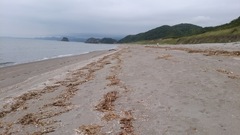
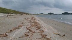
Yurigahama BeachYoroncho, Kagoshima Prefecture
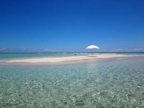
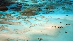
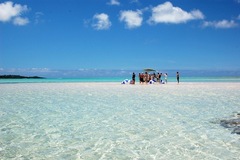
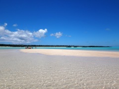
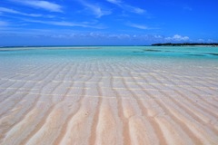
On the eastern coast of Yoron Island, surrounded by coral reefs, Ogane-ku Coast is known for its shallow, sandy beach. About 1.5 kilometers offshore, a sandbar called Yuri Beach emerges only at low...
Category
Nature beaches/shores/coastlinesFavorites -
Kamegaoka MountainMinamisatsuma City, Kagoshima Prefecture
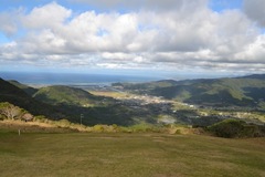
This mountain, with an elevation of 387 meters, features a summit that resembles the shape of a turtle. To the north, it offers views of Fukiagehama, one of Japan's three major sand dunes, while to...
Category
Nature beaches/shores/coastlinesFavorites -
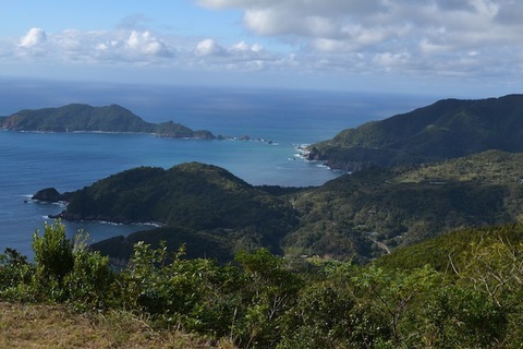
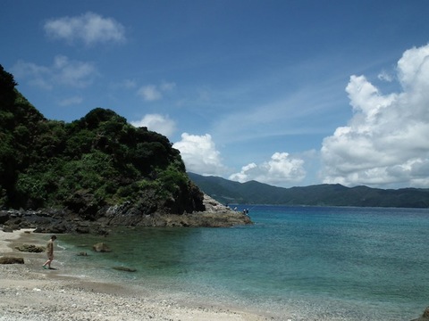
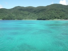
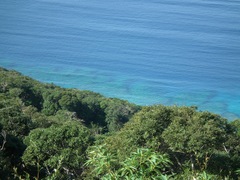
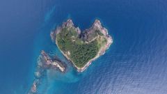
AkimeMinamisatsuma City, Kagoshima Prefecture
This location offers a scenic view of Okiakimejima Island along a ria coastline. Surrounded by blue seas, inlets, and picturesque villages nestled among the mountains, it is a place of great natura...
Category
City Landscapes NatureFavorites -
Kagoshima City TramKagoshima City, Kagoshima Prefecture
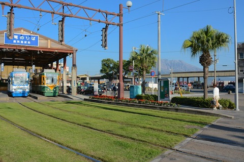
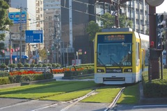
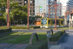
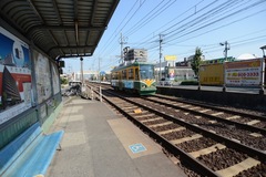
The greening of the tram line covers 8.9 kilometers and approximately 35,000 square meters with a lush green carpet. This initiative helps mitigate the heat island effect, reduce noise, enhance the...
Category
trains/streetcars/monorailsFavorites -
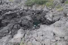
Mizonokuchi CaveSoo City, Kagoshima Prefecture
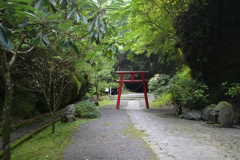
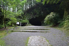
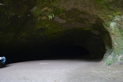
This cave was formed over thousands of years by the erosion caused by spring water in the Kirishima mountain range. It measures 13.8 meters in width and 8.6 meters in height, with a confirmed lengt...
Category
NatureFavorites -
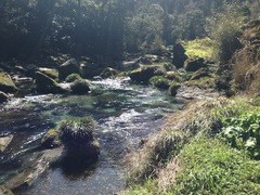
Sanren Todoro WaterfallSoo City, Kagoshima Prefecture
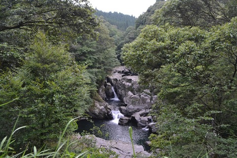
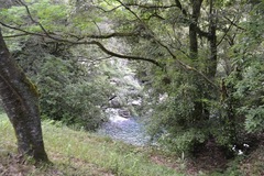
This waterfall is formed by the erosion of firmly consolidated tuff, volcanic flow deposits that have solidified under heat and pressure, as the Mizonokuchi River carves through the rock, creating ...
Category
Nature waterfalls/rivers/streams/canyonsFavorites -
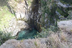
Saneku BeachSetouchicho, Kagoshima Prefecture
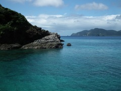
Located in Saneku Village in the northwest part of Kakeroma Island, this beach is known for its exceptionally clear waters, referred to as Saneku Blue, which display various shades of blue. The sha...
Category
Nature beaches/shores/coastlinesFavorites -
Yogan Nagisa TrailKagoshima City, Kagoshima Prefecture
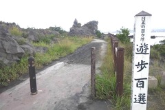
This 3-kilometer-long walkway connects Sakurajima Lava Beach Park and Torishima Observation Point. Constructed on the lava fields formed during the Taisho eruption of 1914, it has been selected as ...
Category
Nature parksFavorites -
Karahama BeachSatsumasendai City, Kagoshima Prefecture

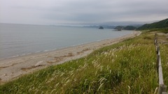

Karahama, located in the northwestern part of Satsumasendai City, features a stunning coastline with approximately 2 kilometers of sandy beach. To the right, wave-eroded rocky mountains create a dr...
Category
Nature beaches/shores/coastlinesFavorites -
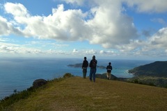
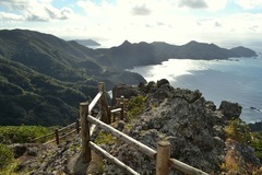
Cape OgonShakotancho, Hokkaido
This small cape is located in Mikuni Town. A walkway leads to its tip, where a 12.6-meter-high observation deck offers a panoramic view of the Japan Sea. From this vantage point, the uninhabited is...
Category
natural reserves/sanctuaries/scenic spots forests/woods views from mountain tops & observatories aerial photos/bird's-eye viewsSpecifications
Parking Available Rest Area (rest station) Available Restrooms Available Places that look like other facilities Use of Drones PossibleFavorites -
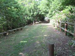
Rusutsu Furusato ParkRusutsumura, Hokkaido
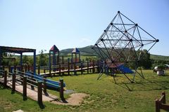
This expansive park covers approximately 10 hectares. Within the grounds, visitors can explore Nire Field, which is equipped with various large and small play structures, a Day Campground where ten...
Category
Nature forests/woods parksSpecifications
Parking Available Restrooms Available Shooting Time Available Requirements for Shootings Places that look like other facilities Use of Water PossibleFavorites -
Shirafura BeachOtobecho, Hokkaido
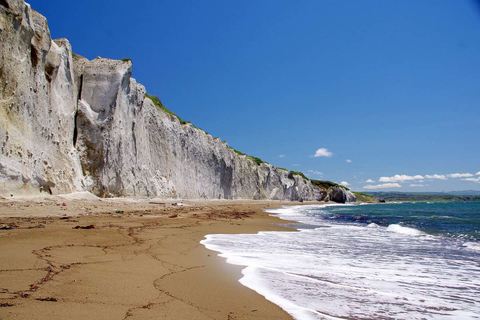
The striking white cliffs, approximately 20 meters high, stretch for about 500 meters, forming a stunning coastline. The name Shirafura is derived from an ancient term meaning "white sloping land."
Category
Nature views from mountain tops & observatories aerial photos/bird's-eye views beaches/shores/coastlinesSpecifications
Parking Available Use of Water Possible Use of Drones PossibleFavorites