Location details
Top > Location List > Fukiwarenotaki Waterfall
Fukiwarenotaki Waterfall
Favorites
Location information
- Name
- Fukiwarenotaki Waterfall
- Address
- Numata City, Gunma Prefecture
- Description
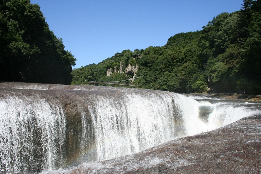
- Fukiware Falls stands approximately 7 meters high and spans about 30 meters in width. The crystal-clear waters of the Katashina River flow over a riverbed of tuff and granite, gradually eroding the bedrock, creating the striking appearance of water splitting the rock as it cascades down. Estimated to have formed around 10,000 years ago, the falls have retreated 750 meters over time.
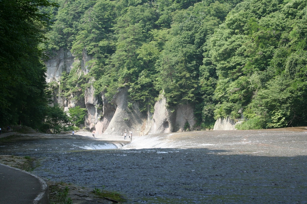
The valley created by this erosion is Fukiware Gorge, where visitors can admire its distinctive natural beauty, including dramatic rock formations such as Hannyagai, along with Fukiware Falls and Matsu Tobizaki Falls. Upstream, at a site called Senjō-daki, the river widens to 100 meters, featuring a floating island in its flow.
A 700-meter walking path follows the left bank, forming a 2,000-meter loop that includes stairs and slopes. In 1936, Fukiware Falls was officially designated a National Natural Monument and Scenic Spot.
- Category
- Nature waterfalls/rivers/streams/canyons
- Specifications
- Parking Available Rest Area (rest station) Available
Contact info for inquiries
- Address
-
1-1-1, Otemachi, Maebashi city, Gunma prefecture, 371-8570
- Website
- https://www.gunma-fc.jp/
- Contact Information
-
TEL:+81-27-898-3695
FAX:+81-27-223-1197
- Contact
- Inquiries on the WEB
Area Map
※ The above map is showing the name of the location and the place name to origin. It's sometimes different from an actual place, so please accept it beforehand.